


The Empire Project group of properties span an area of approximately 4 x 15 km that has remained mostly unexplored for the past century due to sediment cover from glacial Lake Agassiz, which was once the largest lake in North America. With minimal outcrop, early 20th-century prospectors passed through without significant interest, and only a few drill holes or modern geophysical surveys were conducted during initial explorations in the 1950's and 60's In comparison to the adjacent mining districts such as Hammond Reef for gold, Lake des Ille for PGM and Shebandowan for nickle-copper. Further, university and government survey litho-tectonic research groups recently distinguished the Marmion terrane from within the long-standing Wabigoon sub-province of the Superior craton based on the paucity of Archean greenstone belts and the inferred absence of Neoarchean, subduction-related mafic-ultramafic intrusions. Combined with the regional till cover, this distinction has also deterred modern Cu-Ni-PGM exploration in the region. As such, the Empire Project group of properties embodies a truly district-scale exploration strategy.
In 2002, the OGS re-sampled lake sediments in the Wawang Lake area (OFR6076). New data confirmed and enhanced historic data, and delineated new rare earth element (REE) anomalies adjacent to new lead and zinc anomalies. Despite extremely limited bedrock exposure, outcropping alkalic and basic intrusions have been sampled by VR and demonstrate anomalous copper and gold near major magnetic anomalies.
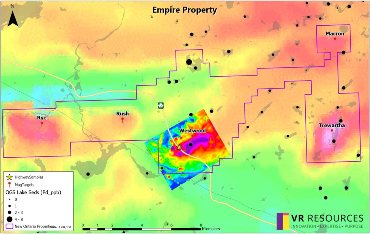
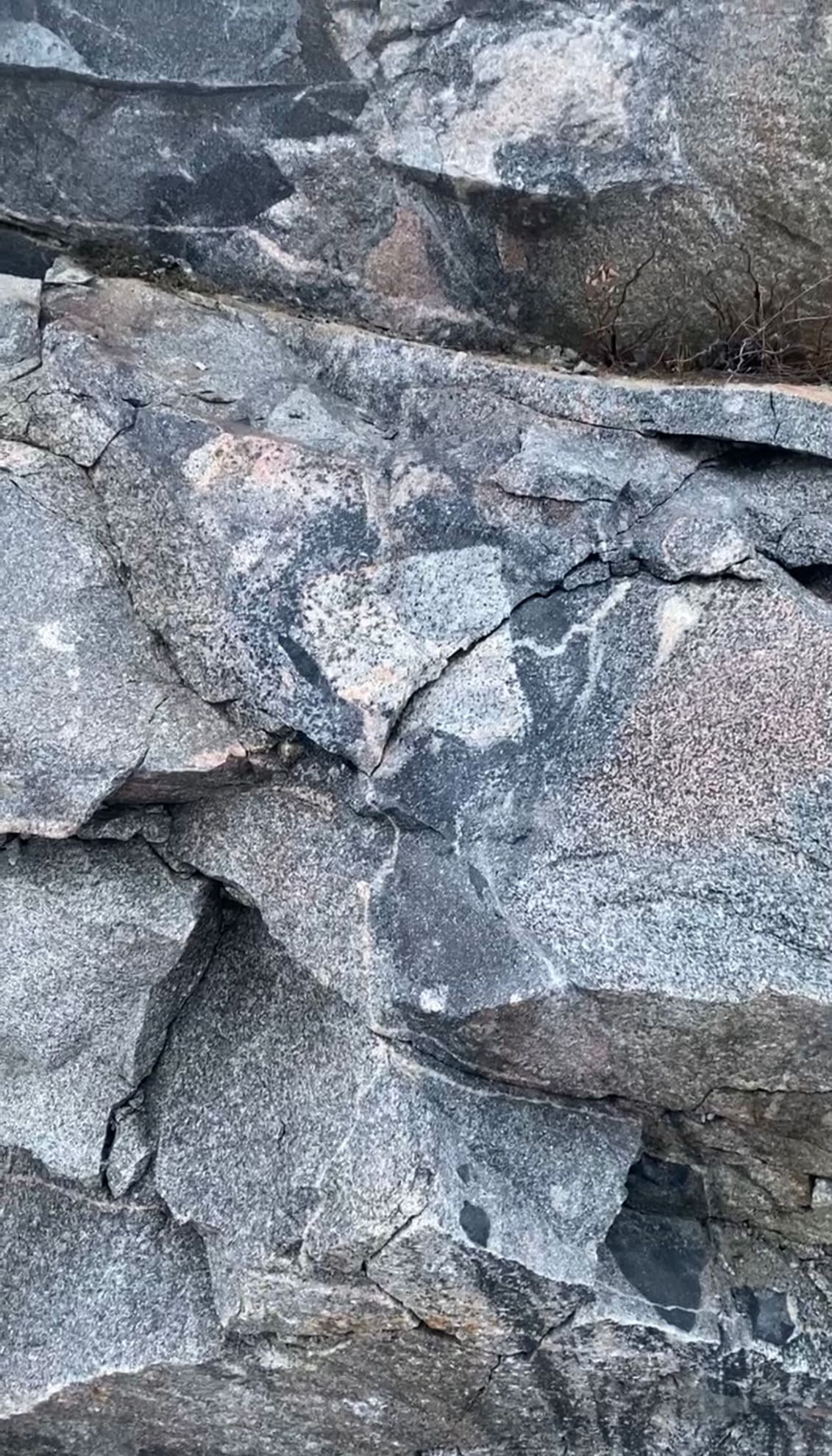
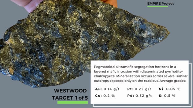
The Lumby Lake greenstone belt is now recognized to be part of the Marmion terrane which is otherwise dominated by 2.8-2.95 Ga tonalite gneiss of continental, metasedimentary origin. There are numerous large magnetic-high anomalies associated with the greenstone belts which are believed to Neoarchean mafic-ultramafic intrusions. Claims acquired by VR Resources in September 2024 cover one such mafic intrusion named Westwood that is adjacent to the TransCanada highway, with 14 new PGE and nickel-copper-chromium anomalies identified by the OGS along trend.
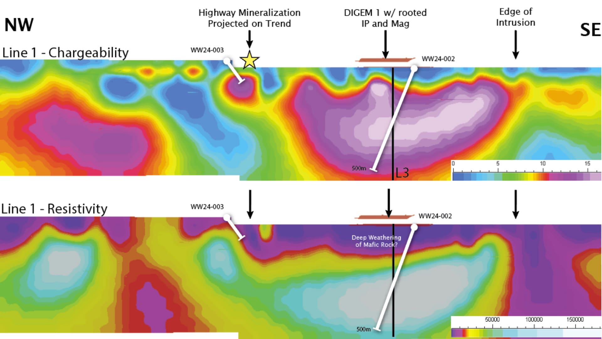
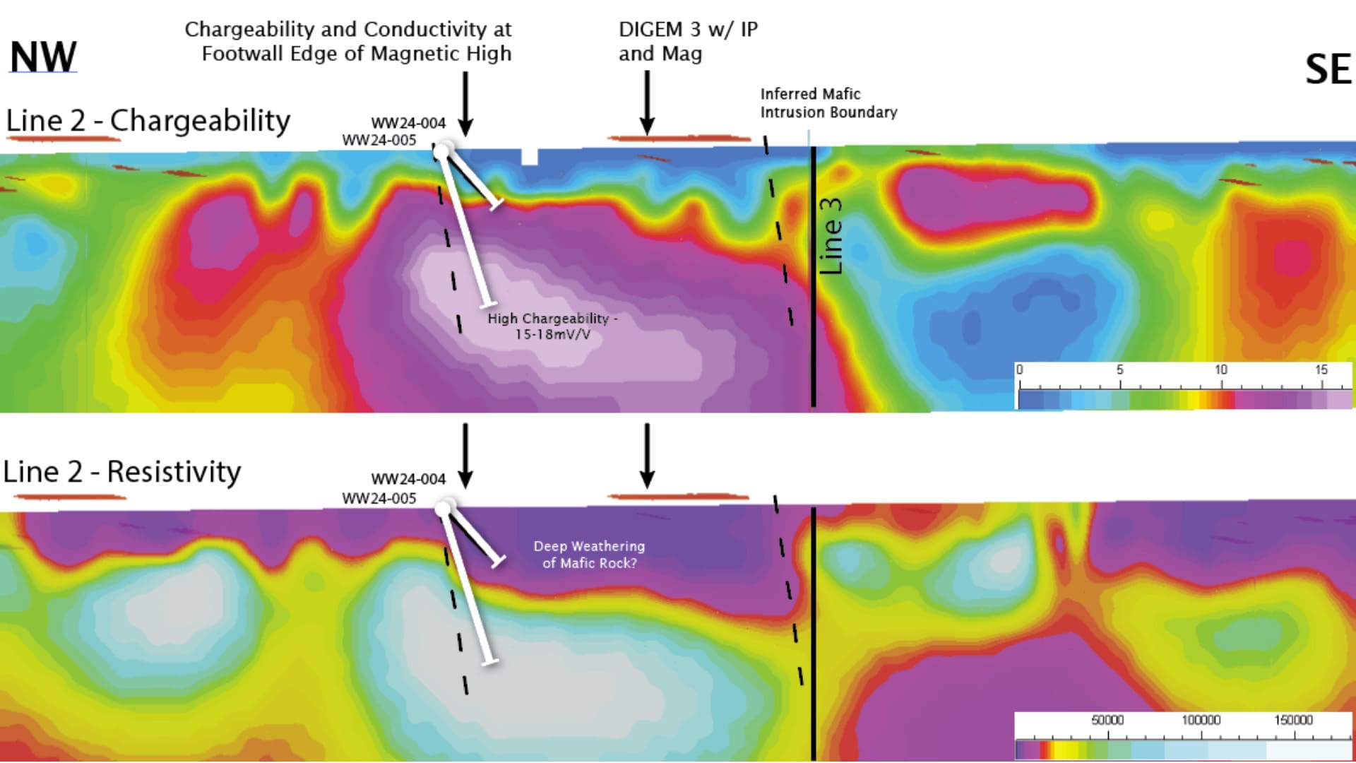
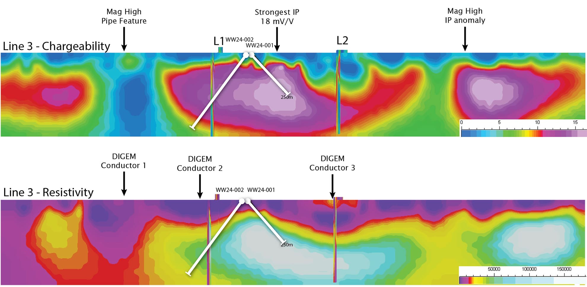
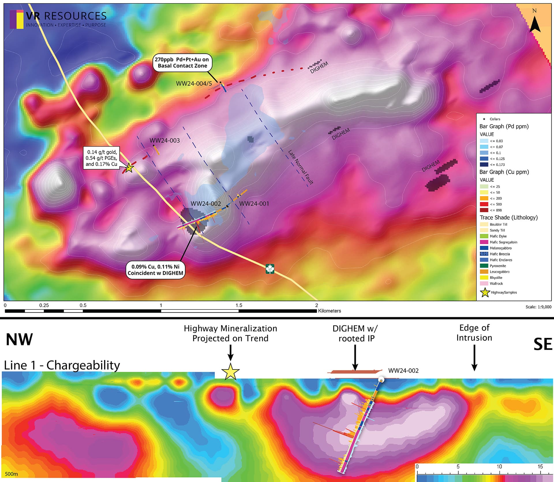
VR completed a regional magnetic data compilation to augment the DIGEM survey completed over the Westwood magnetic anomaly by the property vendor in 2023. VR followed up that desk-top work by completing a state-of-the-art, 3D-array DCIP geophysical survey in the fall of 2024 to identify chargeable and/or conductive sulfide accumulations within the inferred intrusion outlined by the magnetic anomaly at Westwood. Work to date on the Westwood target is as follows:
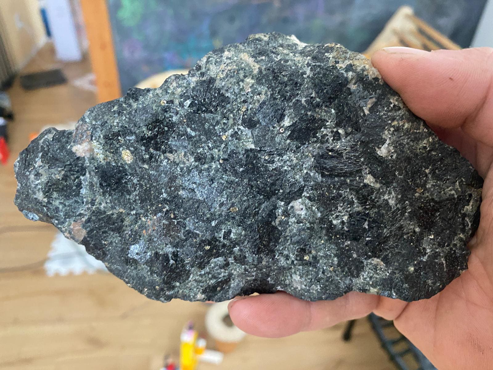
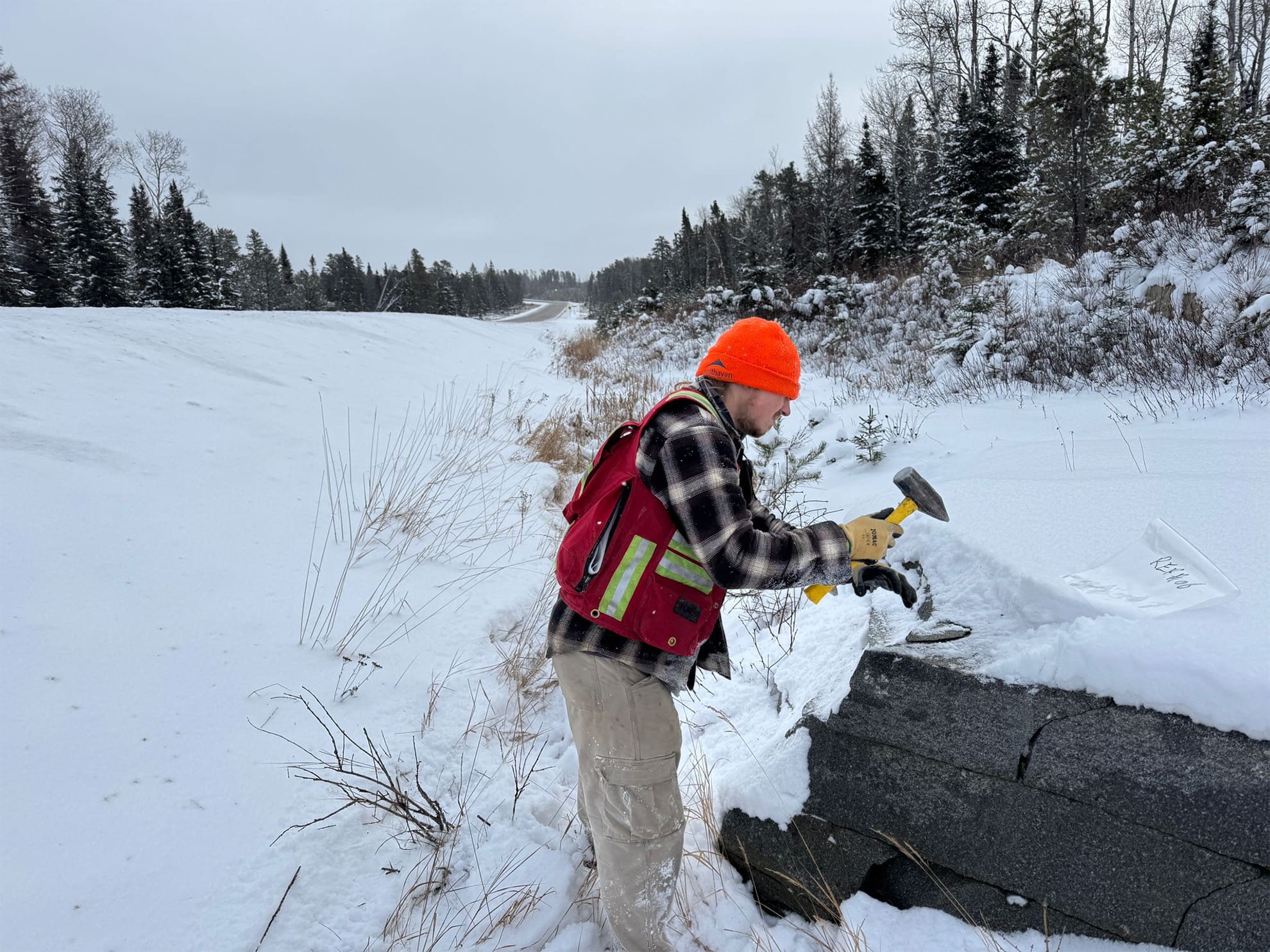
- Surface sampling of the "Highway showing", with an average grade obtained from three grab samples with chalcopyrite-pyrrhotite mineralization exposed near the Trans Canada gives 0.14 g/t gold, 0.54 g/t PGEs, and 0.17% Cu;
- Up to 5 ppb Pd and 108 ppm Cu occur in OGS lake sediment samples taken from directly above magnetic and conductivity anomalies;
- Detailed airborne magnetic and EM DIGHEM survey in 2023 over the Westwood magnetic anomaly, showing strong zonation in the first vertical derivative, and; a large DIGHEM conductor coincident with magnetic trend, and magmatic layering seen in outcrop;
- A DCIP survey encompassing 7 line-km's in three transect lines crossing the Westwood magnetic anomaly, which identified several strong chargeability anomalies ssociated with the edges of the magnetic anomaly;
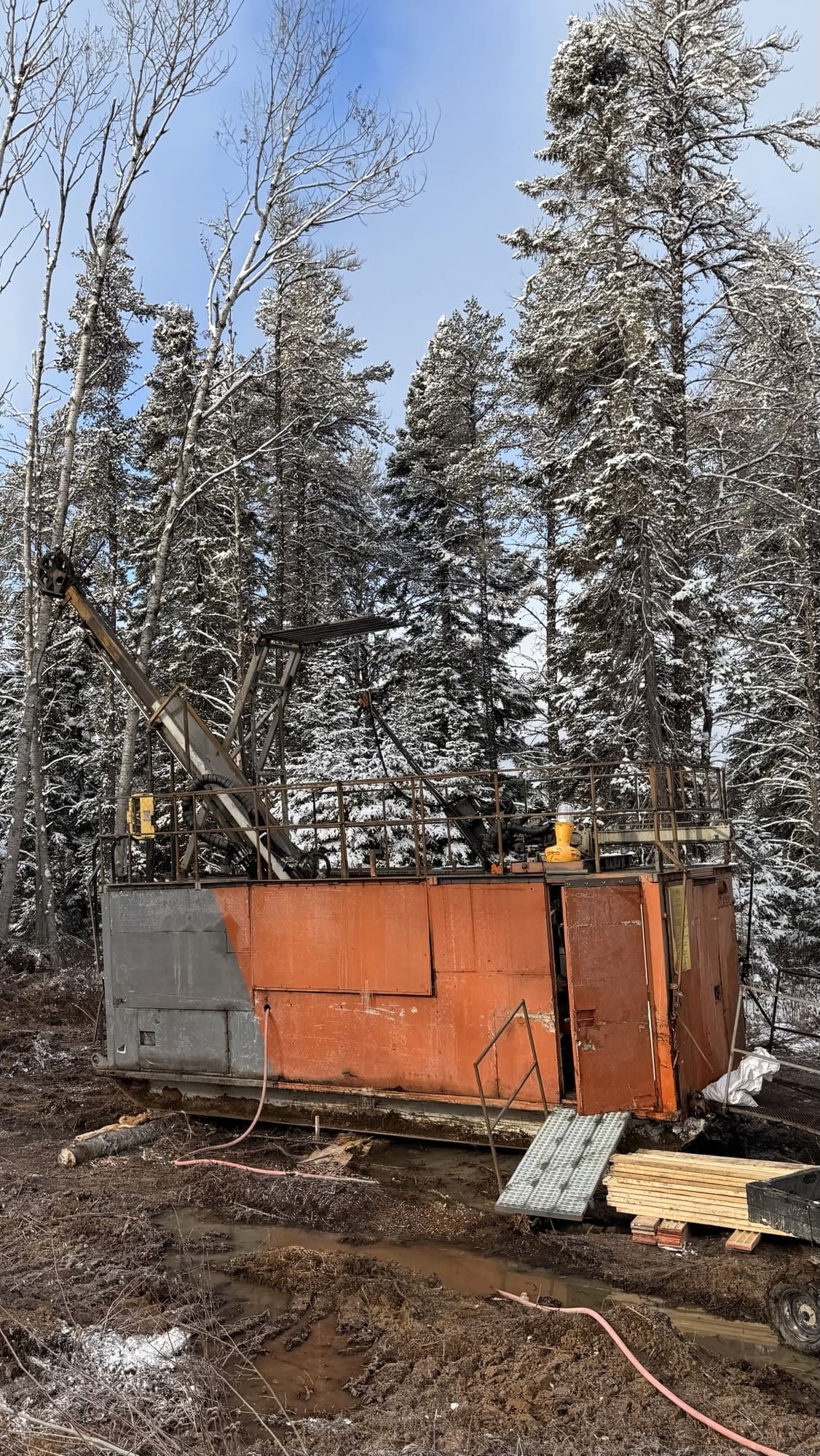
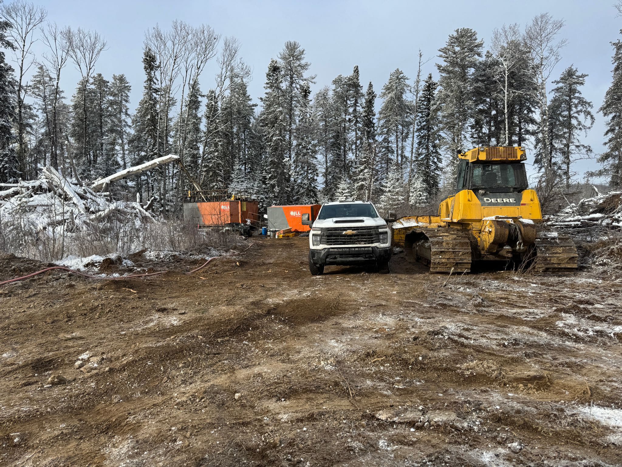
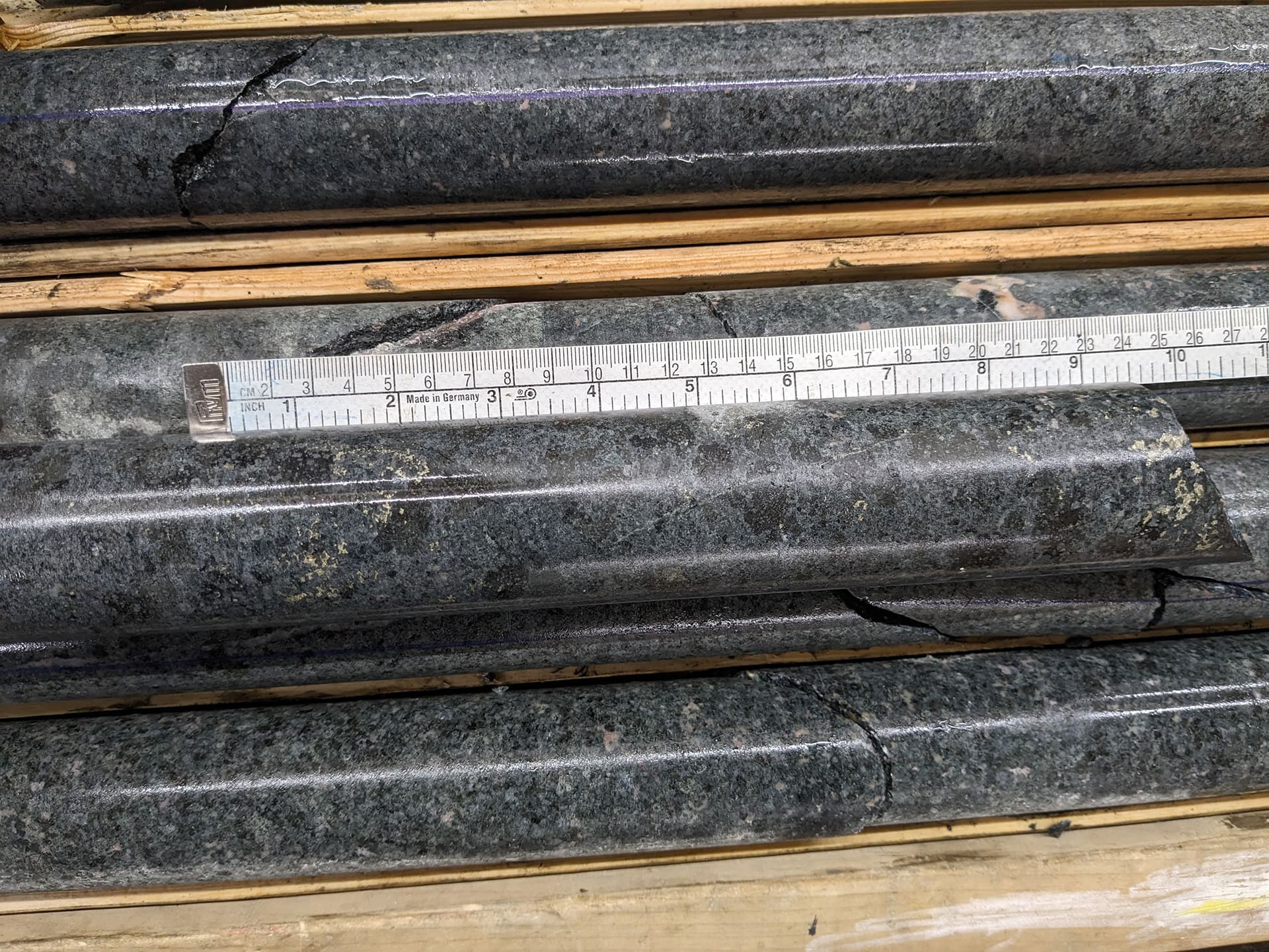
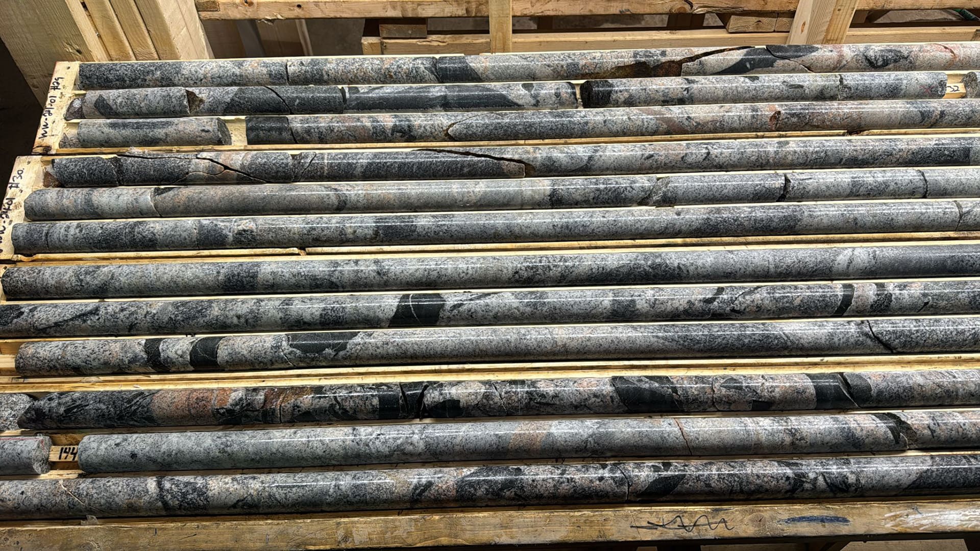
- 1,188 m of drilling in 5 holes completed in December, 2024, which confirmed the presence of a zoned and/or layered mafic-ultramafic intrusion at Westwood, with disseminated and net-textured magmatic sulfides similar in appearance to the outcrop showing adjacent to the Trans Canada highway.
Results from drilling include:
- 1m intervals with 262, 138 and 118 ppb Pd+Pt on the basal contact of the intrusion in Holes 4 and 5 drilled from the same pad near the northwest margin of the intrusion. Sulfide zones have weakly developed segregation textures which are along trend from the highway showing;
- Copper-nickel mineralization up to 0.09% Cu and 0.11% Ni, with anomalous PGE at 320 m depth in Hole 2, drilled near the southeastern margin of the intrusion;
- Evidence for localized sulfide saturation and Ni-Cu-PGE depletion, and enrichment within cumulate textured mafic rocks across the complex.
Overall, the data now in hand for Westwood prove the Cu-Ni-PGE mineral deposit model and mineral potential for the Empire district of magnetic anomalies. Further, the low-cost DIGHEM-magnetic survey used successfully at Westwood can now be applied to our other targets within the Empire project; for example, the Trewartha and Mack magnetic anomalies also believed to be mafic-ultramafic intrusions with the potential for Cu-Ni-PGM mineralization.
Plans Going Forward.
Exploration methods have proven successful at Westwood. Vectors for follow-up drilling in that complex are obvious, and the application of the same exploration strategy to the more recently staked Trewartha and Mack properties located to the west is warranted. In addition, the initial success at Westwood has seeded strategic-level discussions with other exploration and mining companies in regards to potential project partnerships going forward.
VR has been awarded in all five of the five previous OJEP provincial initiatives (Ontario Junior Exploration Grant Program) run by the Ontario government over the past four years. VR has an application in place for the current round, which if again successful, would provide up to $200,000 in funding to exploration on the ground at Empire in 2026.
Work programs have been scoped with various exploration service companies for potential future work:
- — VTEM+ airborne magnetic and EM survey of approximately 1,500 line-km covering the Empire and Mack properties, to identify targets for conductive sulfide mineralization to depths of up to 500 m;
- — Follow-up surface stripping, mapping, prospecting & sampling on the Mack property, to ground-truth and evaluate EM anomalies and magnetic patterns identified and outlined by from the VTEM+ survey.
- — Westwood: complete follow-up drilling to test for: 1. a coarse, late, pegmatoidal intrusive phase with enriched PGM, aka, Lac des Iies, and; 2. cumulate/layered base metal sulfide with Cu-Ni-PGM mineralization at the base of the intrusion.
- — Mack: Evaluate completion of first-pass drill holes at Mack property pending results from the VTEM+ survey and follow-up surface work.
As described in the news release dated February 26, 2026, the Company entered into a binding definitive agreement (the “Agreement”) dated February 25, 2026, with Athos Metals Corp., a private company, pursuant to which the Company has agreed to sell its 100% interest in it’s Rambler, Mack, Empire and Silverback properties located in northwestern Ontario to Athos. It is the intention of Athos to make the district-scale copper-nickel-PGM exploration strategy commenced by VR in 2024 around these four properties its core focus going forward, with the express goal of discovering new, mineralized ultramafic intrusions, anchored by local infrastructure. VR will gain a 9.9% position in the Resulting Issuer as it relates to the Agreement and proposed transaction, thus preserving the future upside potential of the district-scale copper-nickel-PGM exploration strategy that VR developed via active exploration on the ground at Empire and Silverback during the past two years.